↓
 

Rochester Land Surveying

Local Land Surveyors in Rochester, NY

Rochester Land Surveying
  • Home
  • ALTA Survey
  • Boundary Surveying
  • Construction Survey
  • Drone LiDAR Mapping
  • Elevation Certificate
  • Land Surveying
  • Lot Survey – Closing Survey
  • Topographic Survey
  • Blog
  • Contact Us
Home - Page 4 << 1 2 3 4 5 6 … 8 9 >>

Post navigation

← Older posts
Newer posts →

Topographic Surveys Help Identify Opportunities on Sites With Changing Uses

Rochester Land Surveying Posted on June 25, 2026 by RochesterSurveyorJune 24, 2026
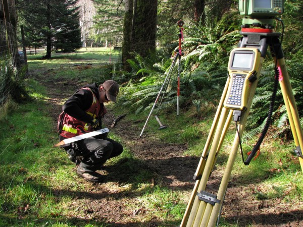
Surveyor using precision equipment to collect topographic survey data for evaluating terrain conditions and future land-use opportunities.

Land rarely stays used for the same purpose forever. A farm may become a residential neighborhood, an old factory lot may turn into a shopping center, or a vacant field may be developed into a public park. When a site changes its purpose, what worked well in the past may not fit the new plan. Topographic surveys create a complete picture of the land’s shape and features. They show not just where things are located, but also how high or low the ground sits, and how water and movement flow across the area. This information turns unknown conditions into clear facts, helping owners and planners see both challenges and new possibilities.

How Topographic Surveys Reveal Physical Characteristics That Influence Future Land Use

Every piece of land has its own unique shape and structure. Some areas are flat and easy to build on, while others slope steeply or have low spots that collect water. These natural traits do not change, but how they affect the land does when its use changes. For example, a gentle slope that was fine for grazing cattle may need careful design before it can hold a building or parking lot.

A topographic survey maps all these details with precision. It records changes in elevation, steepness of slopes, and the location of natural or man-made features. This information helps answer important questions. Can the site support the weight of new structures? Will rainwater drain away safely? Is there enough stable ground to build roads or walkways?

By showing exactly what the land looks like, the survey removes guesswork. It reveals which parts of the site are ready for new use, and which areas need adjustments or special design. This early knowledge saves time and money, and it prevents plans that would not work well once construction begins.

Identifying Natural Features That Can Become Valuable Project Assets

Many people look at hills, trees, streams, or uneven ground and only see limits or extra work. In reality, these same features can become some of the most attractive parts of a new development. A rise in elevation can offer great views, groups of mature trees can provide shade and beauty, and natural channels can be turned into safe drainage paths that also look pleasant.

A topographic survey highlights these features clearly so they can be used to advantage. It helps teams see how to work with the land instead of fighting against it. Common assets revealed through this process include:

  • Higher ground that is ideal for building foundations or scenic overlooks
  • Gentle slopes that can be shaped into terraces or outdoor gathering spaces
  • Natural drainage paths that reduce the need for costly pipes or concrete channels
  • Areas with stable soil that require less preparation before construction
  • Clusters of vegetation that can be kept to add green space and lower maintenance costs

When these features are recognized early, they become part of the design rather than obstacles. This approach often results in a site that works better, looks more natural, and holds greater value over time.

Evaluating Surface Conditions Before Repurposing Existing Properties

When a property moves from one use to another, old assumptions about its condition may no longer apply. Land that was used for storage, industry, or farming may have hidden changes in grade, filled areas, or uneven ground that were never formally recorded. What looks like a flat surface may actually have hidden dips or rises that will cause problems later.

A topographic survey measures every part of the surface in detail. It shows where the ground has been raised or lowered over the years, and it marks any changes that are not obvious to the eye. This data gives planners a true starting point for redesign. They can see exactly how much work will be needed to reshape the land, how much material will have to be moved, and whether the existing layout can support new structures or activities.

This step also helps avoid unexpected costs. If a site has hidden low spots or unstable areas, the survey finds them before construction starts. This means adjustments can be made in the planning stage, when changes are easier and less expensive to make.

Supporting Adaptive Site Planning Through Accurate Terrain Information

Adaptive planning means creating a layout that fits the land rather than forcing the land to fit a fixed idea. This approach produces better results and reduces the amount of work needed to prepare the site. To do this well, designers need exact information about how the ground rises and falls.

Topographic survey data is often turned into detailed 3D models and contour maps. These tools let architects and engineers visualize the whole site from every angle. They can decide where to place buildings to avoid steep slopes, how to align roads to follow the natural flow, and how to shape open spaces to match the existing land.

This information also guides decisions about utilities and drainage. Pipes and lines follow the natural slope whenever possible, so water flows away without needing pumps or heavy digging. The result is a design that works with nature, reduces long-term maintenance, and creates a space that feels right for its new purpose.

Helping Stakeholders Compare Multiple Redevelopment Scenarios

Before choosing a final plan, most development teams look at several different ways to use the land. One option may focus on building more structures, while another may leave more open space. One design may require moving large amounts of soil, while another works with the existing ground shape.

Topographic survey data makes it possible to compare these options fairly. The same set of measurements can be used to test every idea. Teams can calculate costs, check feasibility, and see how each layout will affect the site’s natural features. They can also estimate how much time and effort each option will require, so they can choose the one that offers the best balance of cost, function, and long-term value.

This clear comparison reduces the risk of choosing a direction that later proves difficult or expensive. It gives everyone involved confidence that the final plan is based on real facts, not guesses, and that it will make the most of what the land has to offer.

Frequently Asked Questions

What information does a topographic survey provide about a property?

It records the exact shape of the land, including elevation changes, slopes, depressions, and the location of natural and built features. It also shows how water will flow across the surface and provides the measurements needed to create accurate maps and models.

Why are topographic surveys useful when a property’s use is changing?

They reveal how the land’s physical traits will work with new plans. They show limits and opportunities, help estimate costs, and ensure that any changes to the site will fit safely and logically with the existing ground conditions.

Can natural site features create development opportunities?

Yes. Slopes, trees, streams, and changes in elevation can be designed into views, green spaces, drainage paths, or special areas that add value and character. A topographic survey helps identify these features so they can be used instead of removed.

Who relies on topographic survey data during site planning?

Developers, architects, civil engineers, landscape designers, and local planning officials all use this information. It forms the base for all design, construction, and approval decisions, making sure every part of the project works together.

How do topographic surveys help compare future land-use options?

They provide a single, accurate set of measurements that can be used to test different layouts and plans. This allows teams to compare costs, feasibility, and impact, so they can select the best approach before any work begins.

Posted in topographic survey | Tagged topographic survey

Welcome to Rochester Land Surveying

Rochester Land Surveying Posted on August 18, 2017 by RochesterSurveyorApril 15, 2020

Your Final Stop for ALL of Your Survey Needs!                                         Contact us today for a free quote!

This site is intended to provide you with information on Land Surveying in the Rochester, NY and Rochester area of New York. If you’re looking for a Rochester Land Surveyor, you’ve come to the right place. If you’d rather talk to someone about your land surveying needs, please call our local number at (585) 397-3331 today. For more information, please continue to read.

land surveyingLand Surveyors are professionals who make precise measurements to determine the size and boundaries of a piece of real estate.  While this is a simplistic definition, boundary surveying is one of the most common types of surveying related to home and land owners. If you fall into the following categories, please click on the appropriate link for more information on that subject:

Rochester Land Surveying services:

    1. I need to know where my property corners or property lines are. (Boundary Survey)
    2. I have a loan closing or re-finance coming up on my home in a subdivision. (Lot Survey)
    3. I need a map of my property with contour lines to show elevation differences for my architect or engineer. (Topo Survey)
    4. I’ve just been told I’m in a flood zone or I’ve been told I need an elevation certificate in order to obtain flood insurance or prove I don’t need it. (Flood Survey)
    5. I’m purchasing a lot/house in a recorded subdivision. (Lot Survey – See Boundary Survey if you’re not in a subdivision.)
    6. I’m purchasing a larger tract of land, acreage, that hasn’t been subdivided in the past. (Boundary Survey)

Contact Rochester Land Surveying services TODAY at (585) 397-3331.

Posted in boundary surveying, elevation certificate, land surveying, land surveyor | Tagged boundary survey, land surveyor, land surveyor rochester ny, Rochester Land Surveying

How To Find Your Home On FEMA’s Flood Insurance Rate Maps

Rochester Land Surveying Posted on July 28, 2017 by RochesterSurveyorMarch 10, 2018

What are FEMA flood maps?

flood survey - elevation certificateFEMA’s Flood Insurance Rate Maps (FIRMs) or just Flood Maps are provided after a flood risk assessment has been completed or updated for a community.  This study is known as a Flood Insurance Study.  The FIRM gives you the Base Flood Elevations (BFEs) and insurance risk zones in addition to floodplain boundaries.  The FIRM may also show a delineation of the regulatory floodway.

Once the “insurance risk zone”  (commonly referred to as the flood zone) is determined, actuarial rates, based on these risk zones, are then applied for newly constructed, substantially approved, and substantially damaged buildings.  FEMA uses these rates to determine the insurance rate you will pay for flood insurance

FEMA’s Digital Flood Maps

FEMA discontinued the production and distribution of paper flood maps in 2009 as part of its Digital Vision Initiative. This affected all the Flood Maps, boundary information, and study reports. However, clients can still view the products for free through their website or buy them in digital format.

To view these flood maps online, go to FEMA’s Map Service Center and key in your address (hi-lited area shown here) search for your home.  This will prompt you to then select the map that covers your area.  The Flood Maps are somewhat cumbersome to use online. It is best to go through the tutorial on the bottom right of the address search page for an easier and more effective use of the GIS map.

Posted in construction, flood damage, land surveying, land surveyor | Tagged elevation certificate, FEMA flood map, flood zone, National Flood Insurance Program, NFIP

Post navigation

← Older posts
Newer posts →
Get Quote Button
© Boxer Survey USA
Rochester Land Surveying

Rochester, New York
Phone: (585) 397-3331

Web Development and SEO by:
AuburnBusiness.com, LLC

The owner of this website, Boxer Survey USA, provides coordination of professional land surveying and engineering services in all 50 states. The professional surveying and engineering services provided to you will be conducted by fully licensed professionals in your state.

↑