Some property descriptions read like an old story. They talk about a tree, a fence, or a bend in a creek instead of a lot number. A metes and bounds survey exists to make sense of these old descriptions. It turns confusing old language into a clear, modern boundary that developers and owners can actually use.
Older Property Descriptions Were Written Before Standard Lot-and-Block Systems
Many older parcels were never given a lot number. Instead, they were described using bearings, distances, and physical features on the land. A deed might point to a big rock, a bend in a road, or the property of a neighbor who has been dead for fifty years.
These old descriptions are harder to read than a modern plat. A modern subdivision plat shows a clean grid with lot numbers and clear lines. An old metes and bounds description reads more like walking directions. It says go this far, turn this way, then go that far again.
This is exactly why a metes and bounds survey matters so much for older parcels. If land was divided before lot numbering became standard, this type of survey is often the only way to turn the old words into an accurate map. It bridges the gap between an old legal document and the real, current shape of the land.
Deed Calls May Refer to Features That No Longer Exist
Old deeds love to reference things that do not last. An old fence line. A large tree. A pile of stones. A bend in a creek. The name of a neighboring landowner from decades ago.
These features change over time, and some disappear completely. A tree gets cut down. A creek shifts its path after years of flooding. A fence rots away and gets replaced somewhere else on the property. Even the neighbor named in the deed may have sold the land three or four times since then.
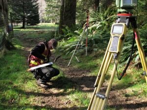
When these references vanish, a surveyor has to work with what is left. Old records get compared against whatever physical evidence still exists on site. Sometimes a stump remains where a tree once stood. Sometimes an old fence post survives even after the rest of the fence is gone. Every clue helps rebuild the picture the original deed was trying to describe.
Bearings and Distances Must Be Reconstructed as a Complete Boundary
A single measurement in an old deed does not mean much on its own. One bearing and one distance only describe one short piece of the boundary. The real value comes from putting every piece together in order.
A surveyor reads through the full sequence of calls in the deed. Each call describes a direction and a distance, one after another, until the boundary comes back around to where it started. Every change in direction matters. Every reference to a monument along the way matters too.
Small errors were common in older surveys. Equipment was less precise decades ago, and human error crept in during the original measurements. A tiny mistake in one bearing might seem small by itself. Stretched across an entire boundary, though, that same small error can shift a corner by several feet. This is why the whole sequence needs careful review, not just one call at a time.
Neighboring Deeds and Historic Records Can Help Resolve Conflicting Descriptions
A single deed rarely tells the whole story. Neighboring properties often share the same boundary line, and their deeds can offer extra clues about where that shared line actually falls.
Older plats add more pieces to the puzzle. So do prior surveys, if any were ever done on the property. Road records can help too, especially when a boundary call references an old road that has since been widened, moved, or renamed. Reviewing the full deed chain, going back through past owners, often reveals details that a single deed leaves out.
Pulling all of these documents together helps a surveyor spot gaps and overlaps. Two old deeds might describe the same boundary slightly differently. One record might be missing a call that another one includes. Cross checking multiple sources is often the only way to resolve these small conflicts and land on one confident answer.
A Metes and Bounds Survey Creates a Clearer Basis for Current Property Decisions
Once a boundary gets reconstructed, it becomes useful for real decisions. A sale can move forward with confidence. A development project can be planned around an accurate lot line instead of a guess. Estate planning gets easier when heirs know exactly what land they are dividing. Boundary adjustments and future improvements all depend on knowing where the real lines sit.
Modern field measurements combined with careful historic research can make an old, confusing parcel much easier to understand. Equipment today is precise. Research today is thorough. Put together, they can finally answer questions that an old deed alone never could.
The real goal of a metes and bounds survey is translation. It takes language written decades or even a century ago and turns it into boundary information that works today. That translation gives property owners and developers something solid to build on, instead of an old story about a tree that fell down years ago.
Frequently Asked Questions
What is a metes and bounds survey?
A metes and bounds survey reconstructs a property boundary using bearings, distances, and physical features described in an older deed. It is common on parcels created before modern subdivision plats existed. A licensed surveyor combines historic records with current field measurements to define the boundary. The result is an accurate, present-day description of the property.
Why do old deeds use trees, rocks, and creeks instead of lot numbers?
Before subdivision platting became standard, landowners described property using whatever features were visible at the time. This often meant natural landmarks, old fences, or nearby roads. These descriptions made sense to people at the time the deed was written. They become harder to interpret decades later once those features change or disappear.
What happens if a landmark mentioned in the deed is gone?
A surveyor works around a missing landmark using other evidence. This can include nearby monuments, neighboring deeds, old plats, and prior survey records. Physical clues like stumps or old fence posts sometimes still exist on site. Combining these sources helps rebuild the boundary even without the original feature.
Can small errors in an old deed really affect the whole property?
Yes. A small mistake in one bearing or distance can shift a corner significantly once it carries across the full boundary. Older surveys were done with less precise equipment than what is available today. This is why a surveyor reviews the entire sequence of calls together, rather than treating each measurement as separate. Catching these small errors early prevents bigger boundary problems later.
Do neighboring properties matter when resolving an old boundary?
Yes, neighboring deeds often describe the same shared line and can confirm or clarify its location. Old plats, road records, and prior surveys tied to adjoining parcels add useful context. Comparing multiple records helps a surveyor catch gaps or conflicts in a single deed. This cross-checking often provides the missing piece needed to finalize a boundary.