
↓
 

Rochester Land Surveying

Local Land Surveyors in Rochester, NY

Rochester Land Surveying
  • Home
  • ALTA Survey
  • Boundary Surveying
  • Construction Survey
  • Drone LiDAR Mapping
  • Elevation Certificate
  • Land Surveying
  • Lot Survey – Closing Survey
  • Topographic Survey
  • Blog
  • Contact Us
Home - Page 2 << 1 2 3 4 … 13 14 >>

Post navigation

← Older posts
Newer posts →

When Should a Land Surveyor Review a Property Before a Porch Expansion?

Rochester Land Surveying Posted on October 22, 2026 by RochesterSurveyorOctober 21, 2026
Land Surveyor Review Before a Residential Porch Expansion in Rochester, New York

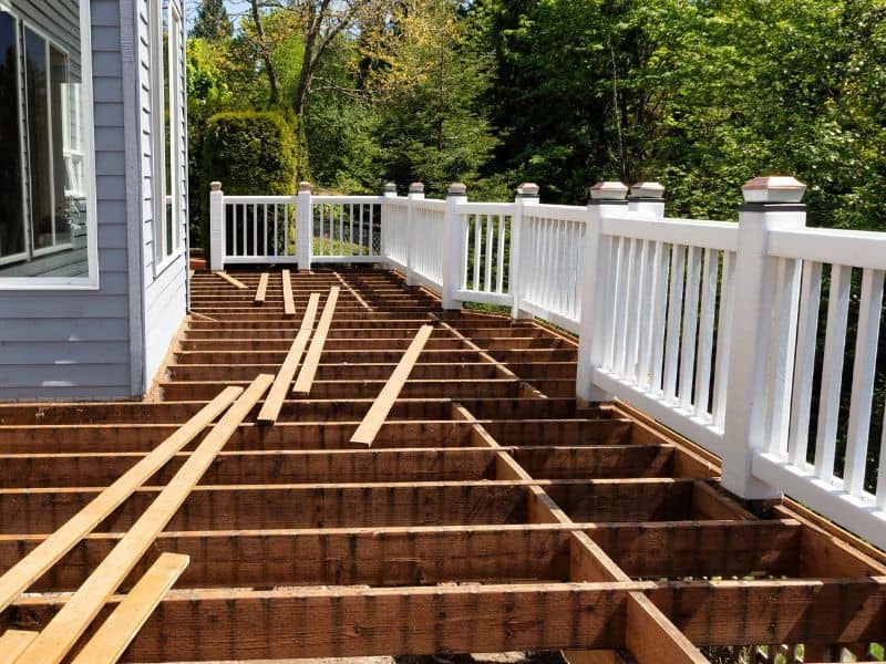
On paper, a porch addition looks like a small project. It’s a few more feet of decking, a new set of posts, and maybe a roof to match the house. Yet that new space is often the part of a home that sits closest to a property line, a side yard limit, or a buried utility line.

The best time to bring in a land surveyor is before you finalize plans and before you apply for a permit. A short review at that stage can confirm where your lot lines are, how much room the setback rules leave you, and whether any easements cross the area you want to build on. Catching a problem on paper costs far less than moving footings after an inspector or a neighbor raises a concern.

Reviewing Property Boundaries Before Extending an Existing Porch

Your first is confirming exactly where your property ends. Many owners assume a fence, hedge, or driveway edge marks the line, but those features are often off by a few feet. A boundary survey locates the actual corners and lines based on your deed, recorded plats, and markers found in the field.

This matters more for porch work than many people expect. Front and side porches usually extend toward the street or a neighbor, and those are the directions with the least room to spare. If the expansion crosses or crowds the line, you could face a stop-work order, a dispute with the neighbor, or trouble when you sell.

If you already have an older survey, a surveyor can tell you whether it still reflects current conditions. Markers get pulled out during landscaping, and older drawings may not show later changes to the house. A quick update is usually easier than trying to rebuild that history yourself.

Checking Setback Requirements for Covered and Uncovered Porch Additions

A setback is the minimum distance a structure must stay from a property line or right-of-way. Local zoning codes set these distances, and they can vary by zoning district, lot type, and project scope. A land surveyor measures the real distance from your house to each line, so you know how much room the setback actually leaves.

Some codes treat covered and uncovered porches differently. An open deck or uncovered stoop may be allowed to extend a short distance into a setback. A porch with a roof is often treated as part of the main building. Adding a roof, walls, or screens can also change how your local office classifies the space. Check with your building or zoning department before you settle on a design, since these rules are set locally and can change over time.

Identifying Easements That May Affect Porch Footings and Support Posts

An easement gives someone else, such as a utility company or a neighbor, a legal right to use part of your land for a set purpose. Easements are often recorded in your deed or on a subdivision plat. They’re easy to forget because nothing on the ground shows where they are.

Porch footings and support posts go into the ground, which is exactly where buried lines run. A surveyor can show recorded easements on a drawing of your lot, so you can see whether the new footprint overlaps one. Building over an easement may require permission from the easement holder, and some holders won’t allow permanent structures at all. You should also call your local utility locate service before any digging. A survey shows legal rights, but it doesn’t replace the marking of live lines.

Measuring Existing Porch Dimensions and Proposed Expansion Limits

Good plans start with accurate measurements of what’s already there. A surveyor records the size and position of the current porch, the house walls, the steps, and nearby features like walkways or trees. Those numbers become the base for your design and help your contractor avoid guesswork.

Once the existing conditions are on paper, the surveyor can show the most you can add while staying inside setbacks and outside easements. Owners often find they have more room on one side than the other. Some discover that a wraparound design fits better than a deeper porch. Knowing your limits early lets you and your designer make smart trade-offs instead of redrawing plans later.

Coordinating Survey Measurements Before Permit Submission and Construction

Many building departments ask for a plot plan or site plan that shows where the porch will sit on the lot. Survey-based measurements make that drawing more reliable and can help the review move along. Requirements can vary by municipality and project size, so confirm the submission list with your local office early.

Timing matters once construction begins, too. A surveyor can stake key points, such as the outer corners of the new porch, so the builder sets footings in the approved spot. Some owners also ask for a final check after the work is done, which can help with inspections, refinancing, or a future sale. Book the survey well before your contractor’s start date so a scheduling delay doesn’t hold up the whole project.

Frequently Asked Questions 

When should I hire a land surveyor for a porch expansion?

Hire a land surveyor before you finalize your design and before you apply for a permit. That timing lets the boundary, setback, and easement findings shape your plans from the start. Waiting until construction begins can lead to costly changes if a problem turns up. Many owners schedule the survey around the same time they start talking with a contractor.

Does an existing porch need a new survey before being enlarged?

Not always, but an older survey may not show current conditions. Markers can go missing, and the drawing may not include past additions or changes. A surveyor can review what you have and tell you whether an update is needed. Your permit office or lender may also have its own requirements, so ask them early.

Can a covered porch have different setback requirements than an uncovered porch?

Yes, many zoning codes treat them differently. An uncovered deck or stoop is sometimes allowed to extend a short distance into a setback. A roofed porch is often treated as part of the house and may need to meet the full setback. Rules vary by municipality, so confirm with your local zoning office before you design.

Can a porch expansion extend into a utility easement?

It depends on the terms of the easement and the position of the easement holder. Some holders allow minor structures with permission, while others don’t allow any permanent building. Footings and posts are a special concern because they may sit near buried lines. A surveyor can show where the easement lies so you can contact the right party before you build.

What survey documents may be needed for a porch expansion permit?

Many offices ask for a plot plan or site plan showing the lot lines, the house, and the proposed porch with distances to each line. Some may accept an existing survey, while others want an updated one. The exact list can vary by municipality, project size, and property type. Call your building department first, then share their checklist with your surveyor.

Posted in land surveyor | Tagged land surveyor

FEMA Elevation Certificate Planning for Finished Basements Near the Genesee River

Rochester Land Surveying Posted on October 15, 2026 by RochesterSurveyorOctober 13, 2026
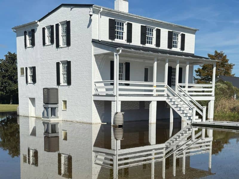
Floodwater around an elevated home illustrating FEMA elevation certificate considerations in Rochester, New York.

A finished basement can add a family room, a guest suite, or a home office without changing the footprint of the house. On a lot close to the Genesee River, that same space can sit right at the level where flood risk gets measured. The height of that basement floor often shapes flood insurance pricing, permit review, and resale questions for years.

An elevation certificate is a FEMA form that records how high key parts of a building sit compared to the expected flood level. If you’re thinking about finishing a basement, get the certificate, or at least the survey data behind it, before the first sheet of drywall goes up.

Why Finished Basements Need Careful Elevation Review

FEMA treats a basement as the lowest floor when it’s below ground on all sides. That means the basement slab, rather than the main floor, usually sets how the building is rated. One number on the form can move your premium more than anything else on it.

Finishing the space raises the stakes. Drywall, flooring, built-ins, and furniture are costly to replace after water gets in. Flood insurance through the National Flood Insurance Program also limits what it covers in a basement, so many finished items may not be covered at all.

Homes near a river can also deal with high groundwater and seepage during spring melt and heavy rain. Those problems aren’t the same as a mapped flood event. They still add to the case for knowing exactly where your floor sits.

Identify the Correct Flood Elevations for the Property

The first step is finding the Base Flood Elevation, or BFE. The BFE is the height floodwater is expected to reach in a flood with a 1 percent chance of happening in any given year. It comes from the Flood Insurance Rate Map (FIRM) and the Flood Insurance Study for your area.

A surveyor should confirm a short list of map details before any field work. Each one affects how the final numbers are read. Here’s what to expect them to check:

  • The flood zone your building sits in
  • The FIRM panel number and its effective date
  • The BFE at the building location, or how it was estimated if none is published
  • The vertical datum the map uses

That last item gets missed more often than you’d think. Older maps and benchmarks may use NGVD 29, while newer data usually uses NAVD 88. Mixing the two can throw your comparison off, so the surveyor converts everything to one datum before comparing anything.

Some parcels fall in zones with no published BFE. In those cases, the flood elevation may need to come from other sources or a local determination, and accepted methods can vary by community. Your local floodplain administrator can tell you what they’ll accept.

Document Basement Floor and Building Elevations

The surveyor sets up from a known benchmark and measures the points FEMA asks for on the form. These shots are tied to the same datum as the flood map. The results go into Section C of the certificate.

For a home with a basement, the key measurements usually cover the lowest parts of the building and the ground around it. These are the numbers your insurer and local officials look at first. Typical items include:

  • Top of the bottom floor, which is the basement slab
  • Top of the next higher floor
  • Lowest elevation of machinery and equipment, such as a furnace, water heater, or electrical panel
  • Lowest and highest adjacent grade next to the building

The surveyor also picks a building diagram that matches how your home is built. A house with a full basement uses a different diagram than a slab or crawlspace home. Current photos of the building become part of the record too.

Equipment location is easy to overlook. If the furnace and water heater sit on the basement floor, that low point gets recorded. Raising or moving them during a remodel can change what the form shows, so plan that work with the survey in mind.

Compare Surveyed Elevations With FEMA Flood Data

Once the field data is in hand, the surveyor compares the basement floor elevation to the BFE. A floor below the BFE puts the building at higher risk on paper, which usually means higher insurance costs. A floor above it may give you a stronger position with your insurer.

Most basements near a mapped floodplain end up below the BFE. The soil around them is what makes them basements in the first place. Even so, the size of the gap, the flood zone, and the adjacent grade all affect how the numbers are read.

This comparison can also point to other options. If the ground around the home sits naturally above the BFE, a Letter of Map Amendment (LOMA) might be worth exploring. FEMA has specific criteria for that request, so ask your surveyor to review the data with you before you apply.

Plan the Elevation Certificate Before Property Improvements

Order elevation work before you design or permit a basement finish. Many communities limit new finished space below the BFE in mapped flood zones. Larger remodels can also trigger substantial improvement rules, which may require the whole building to meet current flood standards.

Substantial improvement is usually judged by comparing project cost to the market value of the structure. The local floodplain administrator makes that call, and the details can vary by municipality. Learning this before you buy materials can save a lot of rework and money.

A little prep makes the process smoother for everyone involved. Your surveyor, contractor, and insurance agent will all ask for some of the same information. Gather and confirm these items early:

  • Any existing elevation certificate for the property
  • The current FIRM panel and flood zone
  • Permit requirements for basement work from your town or city
  • How the remodel may affect your flood insurance rate
  • Whether a new certificate will be needed when construction is finished

Buyers should follow the same steps. If you plan to finish a basement after closing, ask for the elevation certificate during due diligence. A survey ordered early gives you time to adjust plans, budget, or price before money is committed.

Frequently Asked Questions

Do I need an elevation certificate to finish my basement?

It depends on your flood zone, your community’s rules, and your insurance needs. In many mapped flood zones, local officials want elevation data before approving work below the main floor. Lenders and insurers may also ask for it. Check with your local permit office before you start so the certificate doesn’t hold up your project.

Can I use the elevation certificate the previous owner had?

Often you can, as long as the building and the flood map haven’t changed. A basement finish, a new addition, or a moved furnace can make the old form outdated. A map revision can also change the BFE or flood zone. Have a surveyor review the old certificate to see if it still reflects the property.

Will finishing my basement raise my flood insurance?

Finishing the space doesn’t change the floor elevation itself. It can, however, raise the value of what’s at risk, and much of it may not be covered under a basement policy. Moving equipment or changing the building’s layout can also affect how it’s rated. Talk with your insurance agent before the work begins so there are no surprises.

How long does an elevation certificate take?

Field work for a single home is often finished in a few hours. The office work, including map research, datum checks, and completing the form, takes additional time. Total turnaround can vary with workload, weather, and how complex the site is. Contact a surveyor early if a permit, closing, or insurance deadline depends on the certificate.

Who can prepare an elevation certificate?

A licensed land surveyor, engineer, or architect authorized by state or local law can complete the form. Land surveyors prepare most of them because the work depends on precise field measurements. They also handle benchmark ties and datum conversions as part of their regular practice. Ask any provider to confirm they’re licensed in your state before you hire them.

Posted in elevation certificate | Tagged elevation certificate

What an ALTA Survey Utilities Review Can Reveal Before Redevelopment

Rochester Land Surveying Posted on October 8, 2026 by RochesterSurveyorOctober 7, 2026
Land surveyor carrying surveying equipment at a commercial redevelopment site in Rochester, New York

Old sites hide a lot underground. A former shopping plaza, warehouse, or office park may have decades of water lines, sewer laterals, gas services, and buried cables, many of them poorly documented. An ALTA survey utilities review gives developers and buyers a mapped picture of what serves the property, what crosses it, and which rights other parties hold. Getting that picture before you finalize plans can save a redesign, a delayed permit, or an expensive surprise once the excavator shows up.

Existing Utility Conditions on the Property

An ALTA survey shows the utilities a surveyor can see and document on the property. Under the minimum standards, the surveyor records observed evidence such as manholes, valves, hydrants, meters, poles, transformers, and pipe outlets. That evidence tells you where service enters the site and how lines likely run.

Table A Item 11 goes further, and it’s often the most useful add-on for redevelopment. Item 11(a) shows utilities based on plans or reports the client provides plus what the surveyor observes in the field. Item 11(b) adds markings from a utility locate request, such as an 811 call. Your lender may require one of these, but a developer often benefits from ordering 11(b) even when it’s optional.

Keep the limits in mind. Locate markings are approximate, and public locate services usually don’t mark private lines like site lighting, irrigation, or a private storm system. If your design depends on exact depths or positions, ask about subsurface utility engineering or test pits as a separate service.

Utility Easements and Recorded Rights

A utility easement is a recorded right that lets a company or agency run, maintain, or access lines on your land. The ALTA survey plots easements listed in the title commitment when the documents describe a location that can be mapped. It also notes visible evidence of utilities that don’t match any recorded easement.

That mismatch is worth your attention. A sewer main crossing the middle of a lot with no recorded easement raises title and access questions you’ll want answered early. On the other hand, an old easement on paper may cover a line that was abandoned years ago, and getting it released could open up usable land.

Ask your title company and attorney to review any gaps the survey flags. Release or relocation rules vary by utility provider, municipality, and county. Don’t assume an easement can be moved just because the line inside it looks unused.

Utility Conflicts That Affect Redevelopment Plans

Utility conflicts are places where existing lines or easements interfere with what you want to build. They show up most often in footprints, parking layouts, and new driveways. A building pad that sits over a water main or inside a power line easement usually has to shift, shrink, or wait for relocation.

Common conflicts found on older commercial sites include:

  • Building additions planned over sewer or storm lines
  • New curb cuts that cross gas services or fiber vaults
  • Dumpster pads or loading docks inside an easement area
  • Overhead power lines that limit building height or crane access
  • Shared service lines that also feed a neighboring parcel

Each one carries a cost and a schedule impact. Relocation work often depends on the utility company’s own timeline, which you can’t control. Finding conflicts before site plan approval gives you room to adjust the design rather than paying for changes later.

Survey Data for Coordinating Site Improvements

The utility data in an ALTA survey becomes a working base for your design team. Civil engineers use it to plan new connections, size services, and route storm drainage. Architects use it to set building footprints that stay clear of easements.

Ask for the survey in a digital format your engineers can use, such as CAD files, along with the signed plat. Confirm the horizontal and vertical datum so everyone works from the same reference. If you also need contours or spot grades, adding a topographic survey with Table A Item 5 keeps the utility and grade data in one coordinated drawing.

Contractors benefit too. Clear utility mapping helps with bid accuracy, demolition planning, and later construction staking. Fewer unknowns usually mean fewer change orders.

Using Utility Findings During Project Due Diligence

Use the utility findings to test whether the deal still works. Compare the mapped lines and easements against your concept plan, your budget, and your lender’s requirements. If major relocation is needed, factor that cost and timing into the purchase price or contract terms.

Order the survey early in the due diligence period. Records research, locate requests, and title review all take time, and late findings leave little room to negotiate. Survey needs can vary by lender, title company, municipality, and project scope, so confirm the Table A items with everyone involved before fieldwork starts.

This is general information, not legal advice. Your attorney can advise on easement rights and contract protections. A good surveyor can tell you what the data shows and where more investigation makes sense.

Frequently Asked Questions

Does every ALTA survey show utilities?

Every ALTA survey shows observed evidence of utilities, like manholes, poles, and valves. It doesn’t automatically map underground lines between those features. Table A Item 11 adds that detail using plans, field evidence, and locate markings. Ask for Item 11 if utilities matter to your plans.

What is the difference between Table A Item 11(a) and 11(b)?

Item 11(a) relies on plans or reports you provide plus what the surveyor observes on site. Item 11(b) includes all of that and adds markings from a utility locate request. The 11(b) option usually gives a fuller picture of underground lines. It can also add time and cost to the survey.

Will an ALTA survey find private utility lines?

It may show private lines if there’s visible evidence or if you provide plans. Public locate services typically don’t mark private utilities such as site lighting or irrigation. A private locating firm can mark those lines before the survey. Mention any known private systems to your surveyor at the start.

Can a utility easement be moved for redevelopment?

Sometimes, but it depends on the utility owner, the easement terms, and local rules. Relocation often requires the provider’s approval, engineering, and a new recorded easement. The process can take months and is usually paid by the developer. Raise the question early with the provider and your attorney.

When should I order an ALTA survey with utilities?

Order it as soon as you have a signed purchase contract and a title commitment. Utility findings can change your design, budget, or deal terms. Waiting too long leaves little time to respond to problems. Early ordering also keeps your closing and permit schedule on track.

Posted in alta survey | Tagged alta survey

Post navigation

← Older posts
Newer posts →
Get Quote Button
© Boxer Survey USA
Rochester Land Surveying

Rochester, New York
Phone: (585) 397-3331

Web Development and SEO by:
AuburnBusiness.com, LLC

The owner of this website, Boxer Survey USA, provides coordination of professional land surveying and engineering services in all 50 states. The professional surveying and engineering services provided to you will be conducted by fully licensed professionals in your state.

↑